Famous Places of Saikaidō, Prints 59–69
Saikaidō (西海道, Western Sea Road/Region) included eleven provinces on the western end of the Japanese Archipelago—nine provinces on Kyūshū island and two offshore island provinces, Iki and Tsushima. Prints 59 to 69 of Hiroshige’s Collection of Prints of Famous Places in the Sixty+ Provinces feature sites in Saikaidō.

Note: The numbers on the map above mark the general locations of the famous places in the eleven provinces of Saikaidō. For the exact location of the sites of the famous places, see “Hiroshige’s “Famous Places in the 60+ Provinces” (Google Maps).
Print 59. Chikuzen: Road-in-the-Sea, Hakozaki
Chikuzen Province (northern Fukuoka Prefecture) lay on the northwest coast of Kyūshū, across the Kanmon Strait from Suō Province on Honshū island.
Hiroshige’s print features Umi-no-naka-michi (Road-in-the-Sea), a spit that angles southwest across from Hakata, a town on Hakata Bay (today a waterfront district in northeastern Fukuoka City). The mountain toward the top left of the print is Mt. Tachibana. Toward the lower right margin is a torii and stone lanterns marking the entrance to Ōtake Shrine, on a hill at the end of the spit (beyond the right border of the print).

In 2024, on a misty afternoon before a downpour, we drove up a narrow winding road to the summit of Mt. Komenoyama, for a distant view of Umi-no-naka-michi about ten miles away.
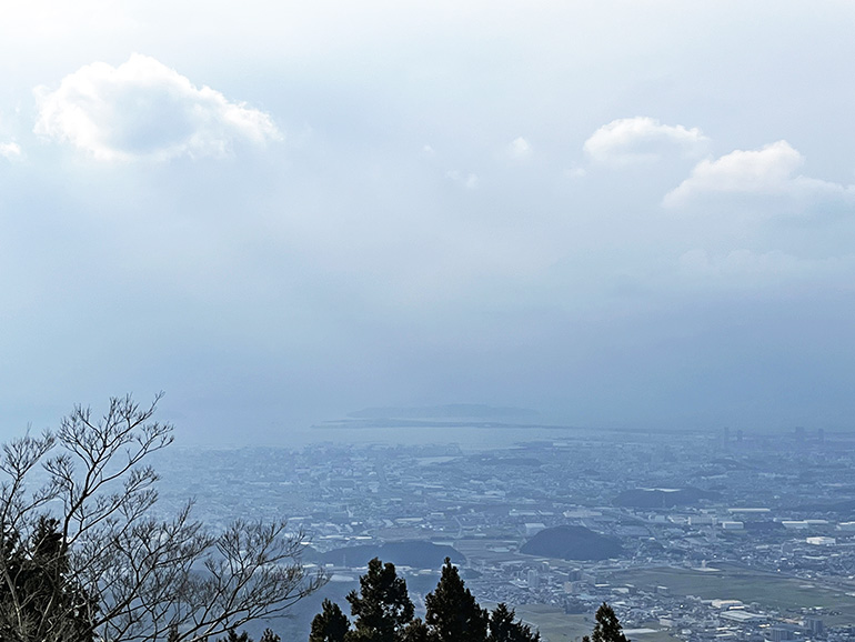
Posted on Google Maps was a clearer view of Umi-no-naka-michi, from Mt. Tachibana, three miles from Umi-no-naka-michi, with a hiking trail to the summit:
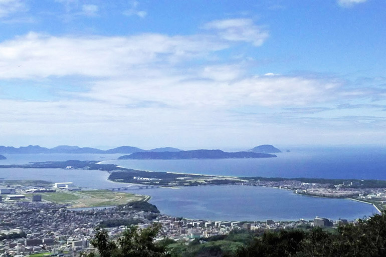
On Shika Island, an observation tower on a hill in Shiomi Park offers a view of Umi-no-naka-michi stretching out from Fukuoka to the island. The sand bar connecting the spit to the island is on the far right; Mt. Tachibana is on the far left.


Print 60. Chikugo: Fish Traps in the Shallow Rapids
Chikugo Province (southern Fukuoka Prefecture) lay south of Chikuzen Province. Hiroshige’s print features the Chikugo River, the longest river in Kyūshū, which flows from Mt. Aso in central Kyūshū into the Ariake Sea on the west side of the island. The village on the far bank is Haki.

The title of the print, “Yana-se” (簗瀬), refers to fish traps (簗) and “rapids, currents, or shallows” (瀬). The print depicts a narrow strip of land in the shallows of the river; the stakes along the strip were used for fish traps, with nets attached along the stakes. Ayu, or sweetfish, swimming downstream in the current entered the traps at the upstream end and were trapped at the downstream end. According to Marije Jansen (Hiroshige’s Journey in the 60-odd Provinces), the platform on poles near the upper mid-right margin of the print were used to store nets.
Today, the town of Haki, on the north bank of the Chikugo River, is just south of the Haki Interchange on the Ōita Expressway. The shallow rapids in front of the town were an ideal place for setting up the fish traps. In the photo below, a low dam crosses the river just above the rapids.

The next famous place in Hiroshige’s print series, “Tunnel to Rakan Temple,” is 24 miles to the northeast, in Ōita Prefecture.
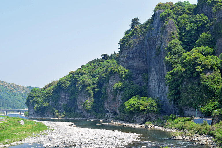
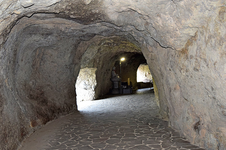
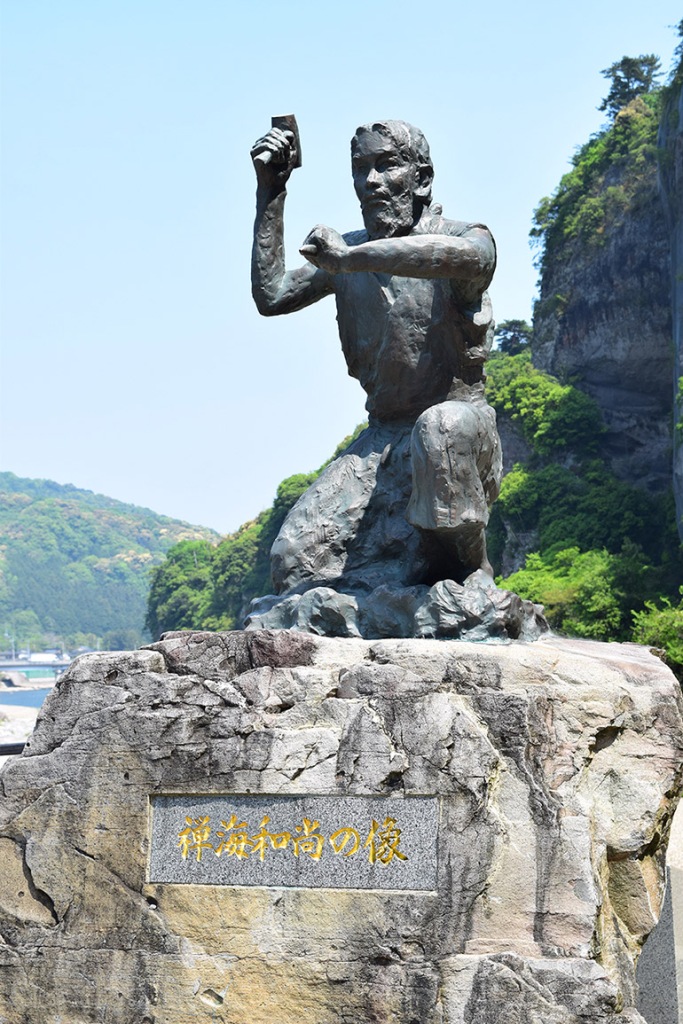
Print 61. Buzen: Tunnel to Rakan Temple
Buzen Province (eastern Fukuoka and northwestern Ōita prefectures) lay Eest of Chikuzen Province, on the northeast coast of Kyūshū. Hiroshige’s print features a tunnel dug along the edge of a cliff along the Yamakuni River. Pilgrims are walking in the tunnel and on the opposite bank of the river. The passageway led to Rakanji, a Zen temple located on a hill about two miles away, on a mountain side above the Atota River, which flows into the Yamakuni River.
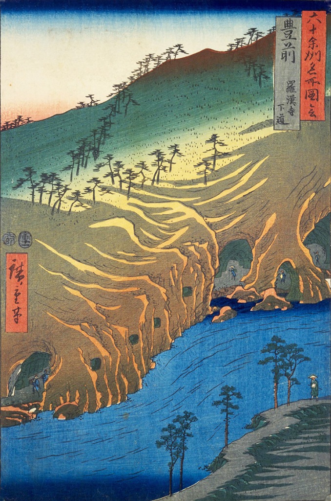
Known as Ao-no-Domon (Blue Tunnel), the passage was the work of a monk named Zenkai, who used only a hammer and chisel to dig the tunnel. He started digging in 1730 and completed the work in 1763. After the tunnel was completed, pilgrims were charged a toll to walk through it.
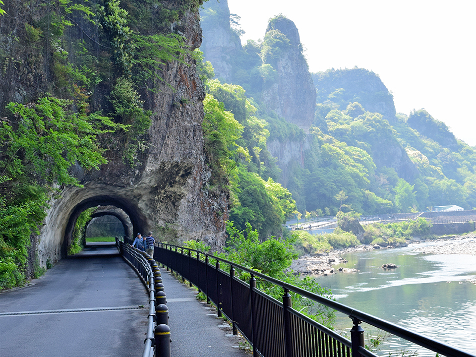
In the tunnel are altars where pilgrims could offer prayers. The tunnel was a passage to rebirth at Rakanji.


Print 62. Bungo: Mino Spit (Minozaki)
East of Buzen Province was Bungo (eastern Ōita Prefecture) on the northeast coast of Kyūshū. Hiroshige’s print features Mino Spit, which curves around the south side of Morie Bay, on the southeastern coast of Kunisaki Peninsula. In the print, a lighthouse sits atop the pile of rocks at the base of the spit toward the right, with ships anchored in the bay and the houses of Morie village to the left.

Today the pine-covered Mino Spit is a recreational area with a country club, a hotel, and camping grounds. When we visited in 2024, a windsurfing club had gathered on the shore of the spit.
Low hills surround the bay. The tall peak in Hiroshige’s print may represent Mt. Kunisaki,


Print 63. Hizen: Mt. Inasa
South of Chikuzen Province (Fukuoka) was Hizen Province (Saga and Nagasaki) on the west coast of Kyūshū. Hiroshige’s print depicts Mt. Inasa above the harbor at Nagasaki.
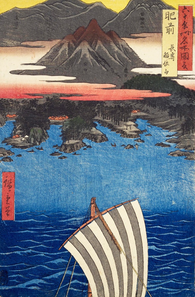
Nagasaki, the capital and largest city in Nagasaki Prefecture today, is a busy port and a center of ship building. It was the only port open to foreign trade during the Tokugawa Period (1600–1868). The city was devastated when the US dropped its second atomic bomb on it in 1945; it was rebuilt after the war.


For photos of other famous places in Nagasaki City and Prefecture, see touring Kyūshū, Part 1.”
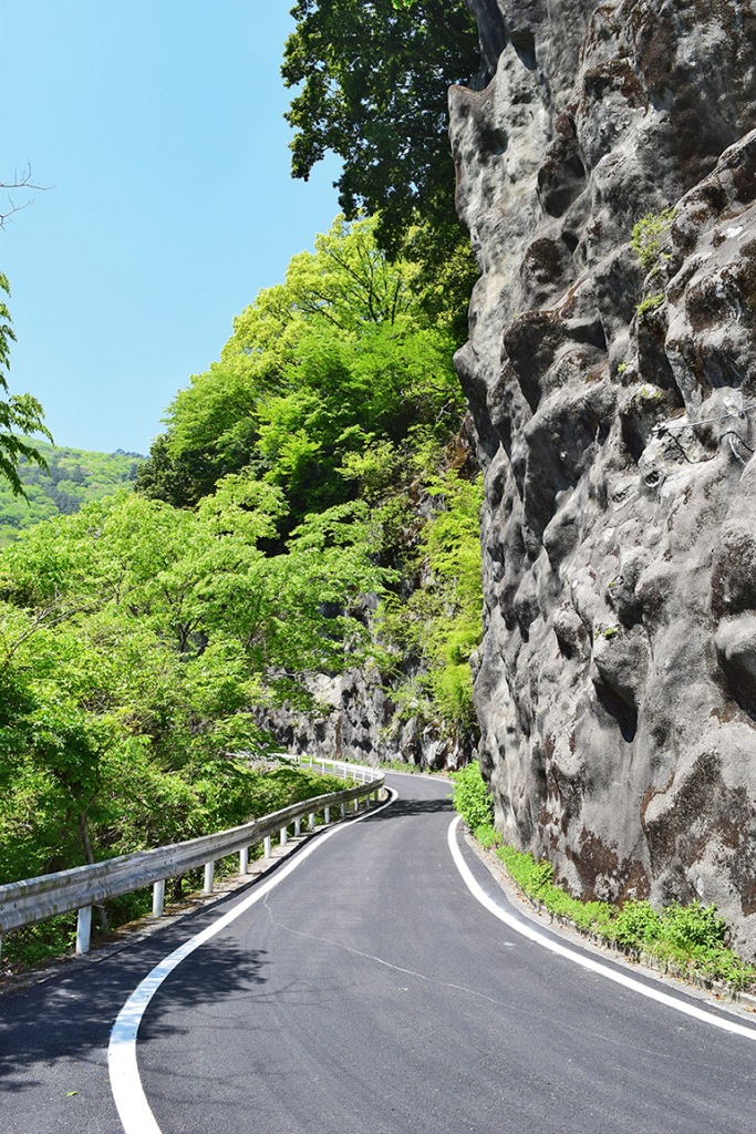
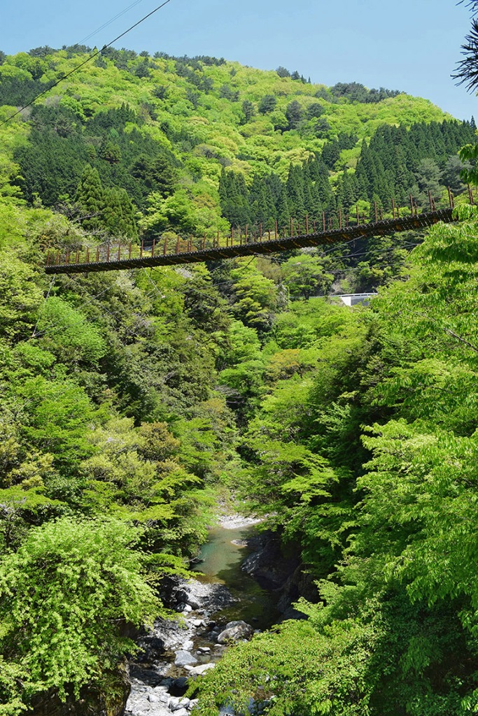
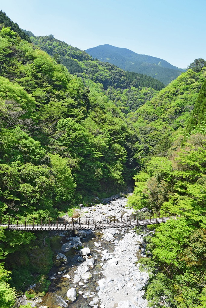
Print 64. Higo: Gokanoshō
South of Chikugo and Bungo provinces was Higo Province (Kumamoto Prefecture) on the west coast of Kyūshū. Hiroshige’s print features Gokanoshō, a village in the Kawabe River Gorge, in a mountainous region noted for its deep valleys and steep cliffs. It was one of the places where the warriors of the defeated Taira clan (Heike) hid from the victorious Minamoto clan (Genji) in the eleventh century.
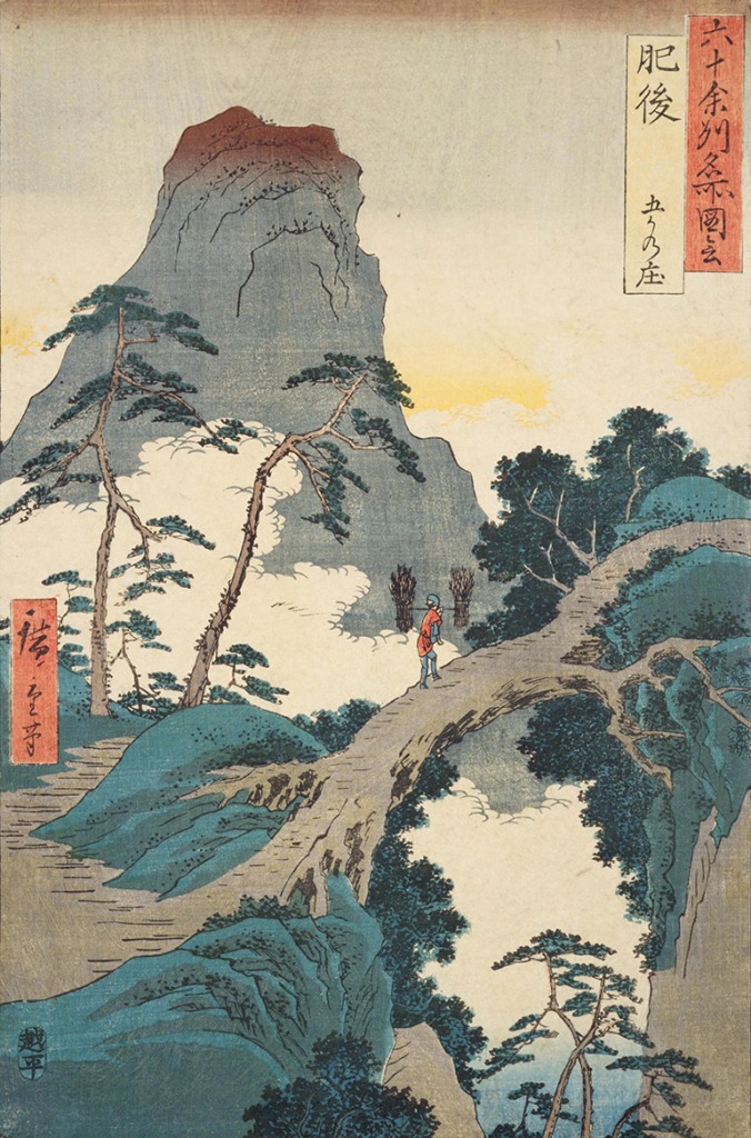
Gokanshō is southeast of Kumamoto City, the capital and largest city in Kumamoto Prefecture. The roads up to the village are narrow, winding, and steep. During the winter, the area is sometimes inaccessible due to heavy snow fall.
Two suspension bridges were built across the gorge of the Kawabe River in 1988.
For photos of other famous places in Kumamoto City and Prefecture, see touring Kyūshū, Part 2.
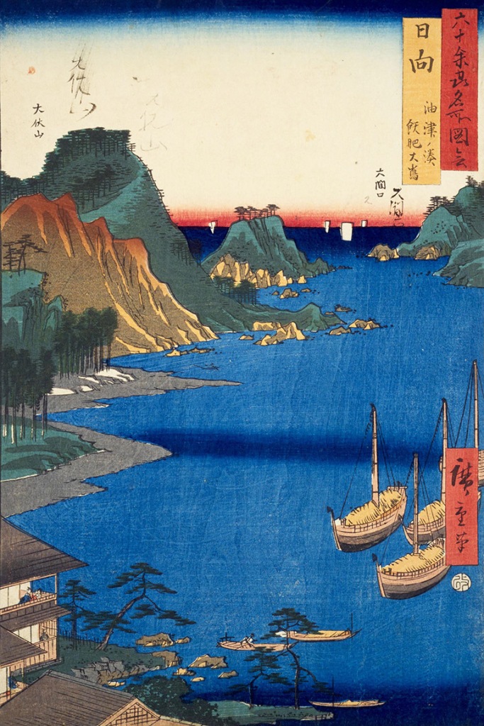
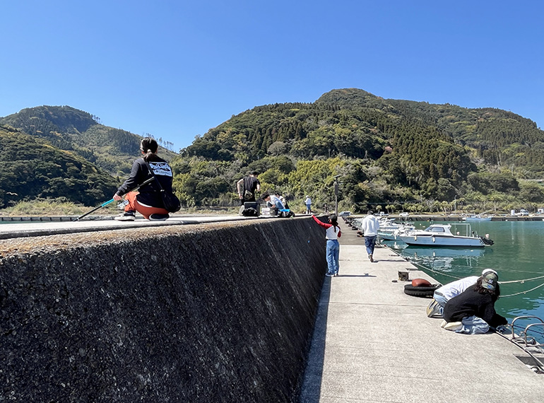
Print 65. Hyūga: Aburatsu, near Obi, Ōshima
East of Higo Province was Hyūga Province (Miyazaki Prefecture) on the southeast coast of Kyūshū. Hiroshige’s print depicts the harbor of the fishing village of Aburatsu near the castle town of Obi. Like Tosa, on Shikoku (see Hiroshige’s print 58), Aburatsu was famous for its catch of katsuo (bonito).
In spring 2024, we drove north along the east coast of Kyūshū to photograph Aburatsu Port.


About five miles inland from Aburatsu Port are the ruins of Obi Castle, which served as the residence of the Ito family, lords of the Obi Domain, for 280 years, from 1588 to the early Meiji Period (1868–1912).

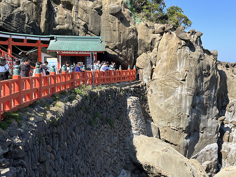
Eight miles north of Aburatsu is Udo Imperial Shrine, built into the side of a sea cliff.
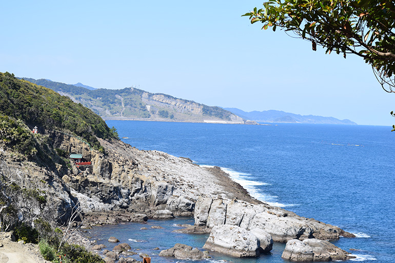
Offshore rocks:


The shrine at Udo (Cormorant House) is the location of the birth hut thatched with cormorant feathers where the sea goddess Toyo-Tama-Hime (Luxuriant Jewel Princess) gave birth to the father of the first emperor of Japan, Jimmu. The shrine is dedicated to Jimmu’s father. On the ceiling of a passage behind the shrine is a breast-like bulge called Ochichi-iwa (Breast Stone), said to be a breast that Toyo-Tama-Hime left behind to feed her child after she returned to her undersea home. The shrine sells a milk candy called ochichi-ame (breast drops), infused with water drippings from Ochichi-iwa.

For photos of a Thanksgiving Festival at Udo Shrine, see touring Kyūshū, Part 1 (Udo Imperial Shrine).
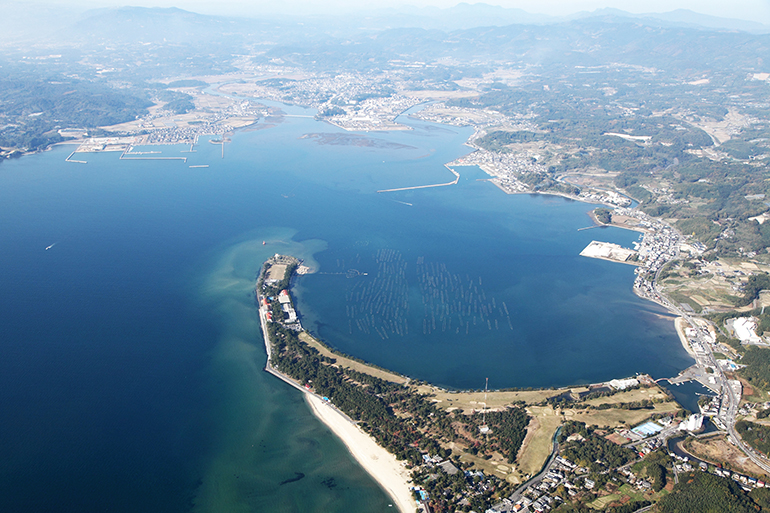
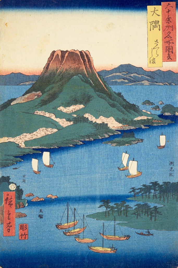
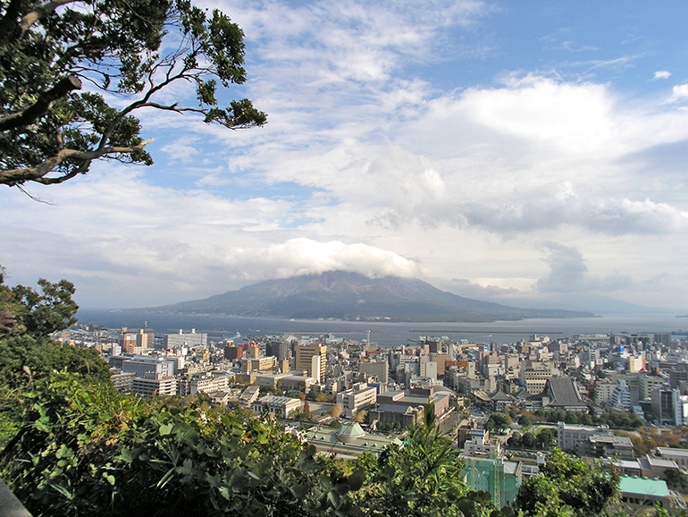
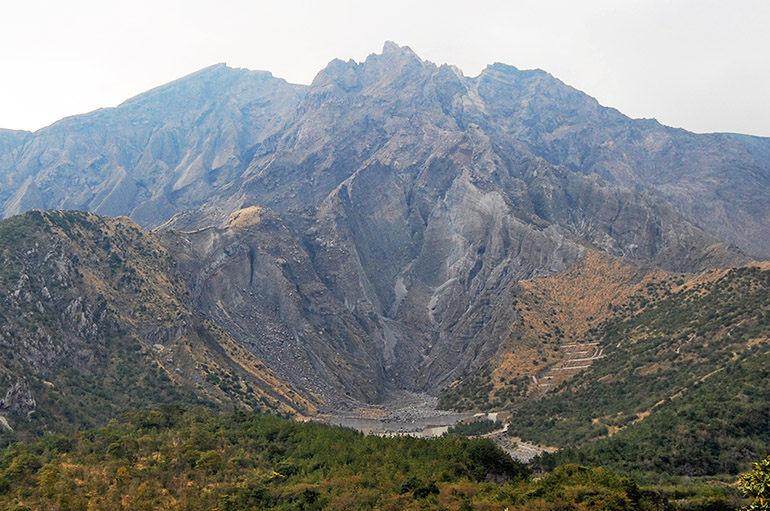
Print 66. Ōsumi: Sakurajima
South of Hyūga Province was Ōsumi Province (eastern Kagoshima Prefecture) on Ōsumi Peninsula. Hiroshige’s print features Sakurajima (Sakura Island), an active volcano on Ōsumi Peninsula, across Kagoshima Bay from the port of Kagoshima. Lava from an eruption in 1914 joined the volcano to Ōsumi Peninsula. In the print, the season is spring, with sakura blooming on the lower slopes of the volcano.
For photos of other famous places in Kagoshima City and eastern Kagoshima Prefecture, see touring Kyūshū, Part 1 and Part 2.”
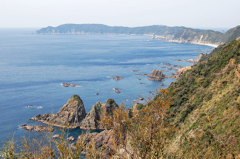
Print 67. Satsuma: Twin Sword Rocks in Bō Bay
West of Ōsumi Province, across Kagoshima Bay, was Satsuma Province (western Kagoshima Prefecture). Hiroshige’s Satsuma print features the Twin Sword Rocks in Bō Bay.
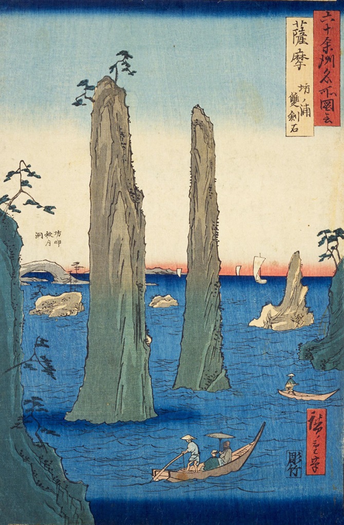
in March 2024, we drove sixty miles from Kirishima to the Kishinkan Observatory at Bo Bay, from where the Twin Sword Rocks is visible between a headland on the peninsula on the south of the bay, and Uno Island.

Past Bō Bay, on the west side of the southern tip of Satsuma Peninsula is Cape Kasasa, famous in Japanese mythology as the place where the Ninigi, the grandson of the sun goddess Amaterasu, met his wife Sakuyahime, the daughter of Ōyama-tsu-mi no Kami, a child of Izanagi and Izanami, who also gave birth to the eight islands of Japan.
On the way back to Kirishima in 2024, we stopped at Bandokorobana Park, 14 miles east of Bō Bay. Kaimondake, known as Satsuma Fuji, was visible on the coast seven miles at the southeastern tip of the Satsuma Peninsula.

For photos of other famous places in western Kagoshima Prefecture, including our drive from Kagoshima City to Cape Kasasa, see touring Kyūshū, Part 2.”
Print 68. Iki from Shisa
Iki Province was an island in the Tsushima Strait between Japan and the Korean Peninsula, west of Chikuzen Province.
In Hiroshige’s print, Iki island is viewed offshore from Shisa village on the west coast of Kyūshū; the island seems to float at the horizon between the ocean and the night sky, at the upper right side of the print. Shisa village appears at the lower left, below Mt. Furo, the snow-covered cone in the foreground of the print. Beyond Mt. Furo is Matsu Bay (Matsu-ura); extending from left to right at mid-print is Hoshika Peninsula. The rounded hill at the end of the peninsula is Shiroyama (Castle Hill).
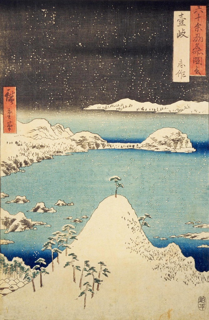
Iki has been inhabited since ancient times; artifacts from the Jōmon Period (10,000–800 BC) have been excavated. During the Heian Period (794–1185), local lords developed the island as a trading hub between Kyūshū and Goryeo kingdom on the Korean Peninsula. Iki’s population was decimated when Mongol armies invaded Kyūshū in 1274 and 1281. During the Muromachi Period (1333–1568), Iki pirates launched raids on Chinese and Korean coastal settlements.
Today, Iki is part of Nagasaki Prefecture and included in the Iki-Tsushima Quasi-National Park. Ferries go to Iki from Hakata Port in Fukuoka City and East Karatsu Port. Cruise ships stop at Gonoura Port on Iki.
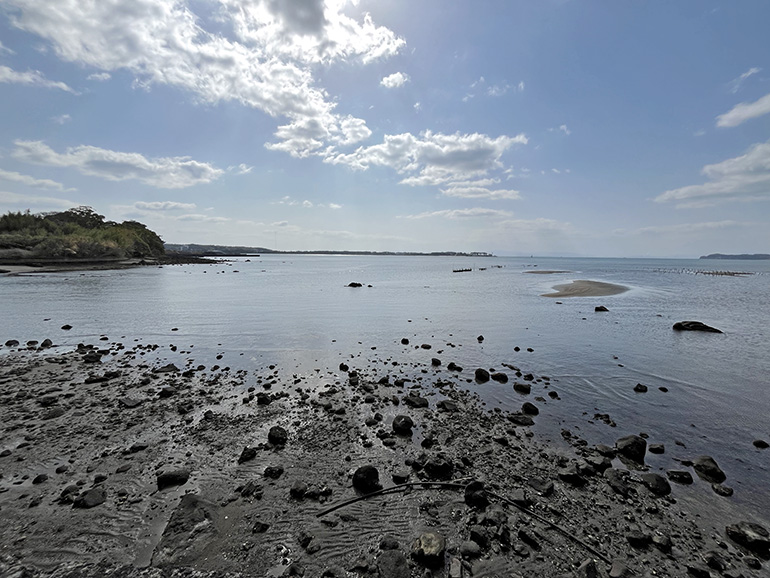
On Google Maps, I researched places to see the landscape in Hiroshige’s print and found two sites in Matsuura, Saga Prefecture. The first was a park at the summit of Mt. Furo, with a view of Matsuura (Shisa), Matsu Bay, and at the end of Hoshika Peninsula, which juts out from the left of the photo, Shiroyama (“Castle Mountain”). Kariya Castle was built on the summit of Shiroyama in the twelfth century; today, only the outline of the castle’s inner compound remains.

The second site was Shiroyama Viewing Platform (城山展望台), eight miles from Mt. Furo Park. On a clear day Iki Island, 26 miles away, is visible as a low faint hump on the horizon.
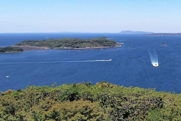
On a clear day in early spring of 2024, a perfect day for photographing Iki, we drove 63 miles from Fukuoka to Mt. Furo. On the way up to Mt. Furo Park, we passed some terraced rice fields, with a view of offshore islands.

Less than half a mile from the summit park, however, we ran into a construction crew repairing the road, which had been damaged by a landslide. The park was closed.
We proceeded to the Shiroyama Viewing Platform. Less than a half a mile from the summit, at the entrance to road up, a sign indicated that road work was being done between February and July. A road block sign was on the side of the road. My partner, who was driving, has a fear of going any place prohibited, so she didnʻt want to proceed beyond the sign. I walked up the road a ways to see if I could see any road work. There was none. I considered walking up to the summit, but changed my mind because it would take too long. When I got back to the car, I decided to let my partner’s reluctance control the situation and agreed that we shouldn’t proceed up. She had been a faithful partner in our far travels in search Hiroshige’s Japan.
Before we left, I took a photo of the summit, over a graveyard where we had stopped.

As we drove away, I looked back at Shiroyama, and saw an early-blooming sakura tree, so we pulled over for a parting photo.

On our way to Nagasaki, seventy-four miles away, to photograph Mt. Inasa (see Print 63 above), I wondered if the road to the Shiroyama Viewing Platform wasn’t closed, that the two signs had been moved to the side of the road to allow access. I felt some regret we hadn’t gone up because I knew I wasn’t coming back and, even if I did, the weather might not be ideal for photographing Iki; the consolation as that I had already seen a photo of the view on Google Maps, so I knew what I might have seen.
It’s possible that Hiroshige had never seen Iki Island either, as he designed some of his prints based on illustrations he saw in earlier travel publications.

Print 69. Tsushima: Sea Coast on a Clear Evening
Tsushima Province was an island in the Tsushima Strait, 30+ miles northwest of Iki Island. Hiroshige’s print presents a bird’s eye view of a fishing village and boats in a small bay on the larger Asō Bay, which divides Tsushima into two parts, Shimo-no-shima (“Lower Island”), to the south, and Kami-no-shima (“Upper Island”), to the north. An evening rainbow arches overhead.
Like Iki, Tsushima has been inhabited since ancient times and served as an outpost for defense and for trade between Kyūshū and the kingdoms of the Korean Peninsula. Fishing was the main industry. Japanese pirates used this island, as they did Oki, as a base for raids on Korean and Chinese coastal areas.
Today, fishing is still the main industry on Tsushima, which like Iki, is part of Nagasaki Prefecture. The island, which is included in the Iki-Tsushima Quasi-National Park, is a tourist destination. Ferries go to Tsushima from Hakata Port in Fukuoka City and from Iki Island. A canal dug through a narrow isthmus at the east end of Asō Bay divided Tsushima into two islands, joined by a bridge.
In 2020, I planned to fly to Tsushima Island from Fukuoka Airport to look for a scene similar to what Hiroshige depicted in his print. Due to the Co-vid pandemic, however, Japan was closed to travel. On Google Maps, I found two sites where I planned to photograph Tsushima, the Mt. Eboshi Observatory and the Kaneda Fort Ruins:

End of Part 8 of 8
Hiroshige’s Famous Places in the 60+ Provinces—Table of Contents
Famous Places in the 60+ Provinces has nine pages (two pages for the Tōkaidō Region and one page for each of the other seven traditional regions of Japan).
- 1. Introduction and Gokinai: Five Core Provinces (Prints 1–5)
- 2a. Tōkaidō: Eastern Sea Road, Iga to Izu (Prints 6–14)
- 2b. Tōkaidō: Eastern Sea Road, Sagami to Hitachi (Prints 15–21)
- 3. Tōsandō: Eastern Mountain Road (Prints 22–29)
- 4. Hokurikudō: North Coast Road (Prints 30–36)
- 5. Sanin-dō: North-Side-of-the-Mountains Road (Prints 37–44)
- 6. Sanyōdō: South-Side-of-the-Mountains Road (Prints 45–52)
- 7. Nankaidō: Southern Sea Road (Prints 53–58)
- 8. Saikaidō: Western Sea Road (Prints 59–69)
- Wikipedia: Hiroshige’s Collection of Prints of Famous Places in the Sixty+ Provinces
- Google Maps: Location of the sites of the famous places, see “Hiroshige’s Famous Places in the 60+ Provinces”
Edo Roads
- Gokaidō: Five Main Roads (Background on roads in Japan during Edo Period, 1603–1868)
- Hiroshige’s Fifty-three Stations of the Tōkaidō (1833–1834; prints and photos of the main road between Edo and Kyōto)
- Hiroshige’s Sixty-nine Stations of the Kisōkaido (1833–1834; prints and photos of the Nakasendō, aka Kisokaidō, the mountain road between Edo and Kyōto)
- Bashō’s Narrow Roads to the Deep North (1689)
- Bashō’s “Sarashina Travel Journal” (1688)

Pacific Journeys: Home and Away
FAMILY AND HOME ||| TRAVELS IN THE PACIFIC ||| ROAD TRIPS IN JAPAN ||| EDO ROADS
